Digital Twin for Real Estate

Bring Your Building to Life

A single intelligent layer for operating, optimizing and reimagining large, complex buildings.

Your building generates thousands of signals a minute. A VisEngine Digital Twin captures them, makes sense of them, and shows you exactly where to act – in a photorealistic 3D model you can walk through. We don’t just visualize your building. We help you run it smarter, cut its costs, and unlock revenue you didn’t know was there.

Interactive Map 8 Deyaar 1024x698

A living digital replica of your building

Not a static visualization – an operational platform. A continuously updated 3D model connected to your IoT sensors, BMS, BIM and business systems, mirroring reality in real time. For towers, mixed-use developments and campuses, it becomes the single source of truth across the asset’s whole life.

The numbers speak

Interactive 3D masterplans consistently outperform traditional sales materials across every key metric

1 %
Typical drop in reactive maintenance with predictive workflows
1
Source of truth across the full lifecycle
1 /7
Continuous health monitoring on every critical asset

Our Interactive 3D Masterplan Applications

Interactive 3D Masterplan Application or an interactive site plan is a tool that helps salespeople in the real estate industry to showcase properties to their customers in person or remotely. This multi-platform application offers extensive functionality, including search by name, location, cost, area size, availability of residential property, and other important features.

Interactive Property Map

All in one – this is how you can describe Interactive Property Map. The most comprehensive information on all projects and the surrounding infrastructure is collected within one application. Save the client’s time on search and research: thanks to the configuration of filters according to the parameters that suit them, the consumers will receive the most helpful information, and as a result, you will have a loyal interested buyer.

Web Interactive 3D Apartment Masterplan

It is the perfect combination of a demonstration of the building’s exterior and the interior of its apartments. Everything is in full view: no corner will go unnoticed because you are one click away from the desired angle. Rotate, filter, and select exactly what you’re interested in. It provides maximum informativity and interactivity for the customer’s convenience.

Web Interactive 3D Villas

Tell clients about your projects in as much detail as possible thanks to Web Interactive 3D Villas Masterplan. Allow viewers to evaluate all the advantages of real estate from all sides. By rotating the plan and reading information about each object of interest, clients can independently assess the benefits of the complex. In addition, clients are unlimited in the choice of angles because they can view objects not only from a top view but also view villa interiors.

Offline/Streaming Interactive 3D Masterplan
Unreal Engine

If you want to surprise your client with the opportunity to explore your project 100%, there is no better way than Streaming Interactive 3D Masterplan. Show them everything and even more. Move as you like and wherever you want, look at the smallest details, apply filters and choose the property you like. You will be delighted with all the benefits of the service!

What platforms does the Digital Twin support?

Supported on Web on all popular browsers

Offline Application on standard PC
Offline Application on Kiosk
Offline Application on large Touch Screen
Mobile and Tablet
iOS and Android

Does it work on mobile and tablets?

Yes, the Digital Twin application is tailored to work on mobile and tablet devices without any limitations. Its user interface and functionality are adjusted to provide a smooth and user-friendly experience.

Why VisEngine?
Visualization pedigree. Engineering depth.

We’re not a BMS vendor learning to render, or a games studio learning to engineer – we’ve done both for 17 years. Our work spans flagship mega-projects including Trojena · NEOM, alongside Emaar, Aldar, Nakheel and Sobha, delivered across Europe and the GCC from our London HQ and Riyadh office.

1 yrs
Of real-estate visuals and data
1 +
In-house specialists
1 +
Corporate customers worldwide

Can it handle multiple projects and infrastructure layers on one map?

Yes, the Interactive Site plan application can be a single project, or it can contain a master map view with multiple projects of the same or a number of different developers. There is no limit on the number of projects that can be added.

Developers Worldwide Trust VisEngine

Nine pillars, one digital twin

Deploy one pillar to solve a problem fast, or combine them into a fully integrated platform. Start where the pain is. Scale when you see the return.

  • Operations & FM –  Real-time monitoring, predictive maintenance, asset lifecycle and automated work orders.
  • Energy & Sustainability – Consumption analytics, carbon & ESG reporting, retrofit modelling, demand response.
  • Occupant Experience – Wayfinding, booking, comfort control and personalized app-based services.
  • Safety & Security – Access control, video analytics, evacuation simulation, first-responder integration.
  • Construction & Commissioning – BIM-to-twin handover, clash detection, as-built verification, digital permits.
  • Tenant & Commercial – Sub-metering, tenant portals, SLA monitoring, lease & floor-plan management.
  • Advanced Analytics & AI – Anomaly detection, what-if simulation, fault diagnostics, LLM assistants.
  • Compliance & Reporting – Regulatory reporting, audit trails; LEED · WELL · BREEAM · ISO 50001.
  • Connectivity & Integration – IoT gateways, Brick · Haystack · RealEstateCore, open APIs, edge computing.
Interactive 3D Masterplan Alaqtar 1 1024x1024

Turn Your Building into a Platform

From concept and BIM handover, through commissioning and operations, into AI-driven analytics – for landlords, developers and operators of large, complex buildings.

Frequently Asked Questions

A Digital Twin is a virtual replica of a building, property, or entire development that mirrors its physical counterpart. It combines 3D visualization with real-time data, allowing stakeholders to monitor, analyze, and optimize assets throughout their lifecycle.

Digital Twins help developers improve planning, reduce errors, and make informed decisions during design, construction, sales, and property management. They also enhance collaboration between project teams and stakeholders.

Yes. A Digital Twin allows potential buyers to virtually explore properties from any location, view layouts, inspect amenities, and understand the project in detail before construction is completed.

Yes. Digital Twins can integrate with BIM, IoT sensors, facility management platforms, ERP systems, and other data sources to provide real-time insights into building performance and operations.

Property managers can use Digital Twins to monitor building systems, track maintenance needs, optimize energy consumption, and identify potential issues before they become costly problems, resulting in lower operating costs and improved efficiency.

The development time depends on the project’s size, complexity, and data availability. A basic Digital Twin can be created within a few weeks, while large-scale developments with advanced integrations may require several months.

Yes. By providing accurate project data, identifying potential issues early, and improving decision-making, a Digital Twin helps reduce costly errors, minimize delays, optimize resource usage, and lower long-term operating expenses.

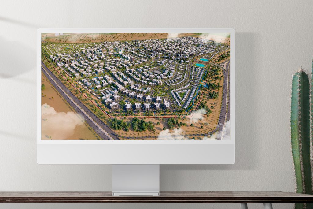
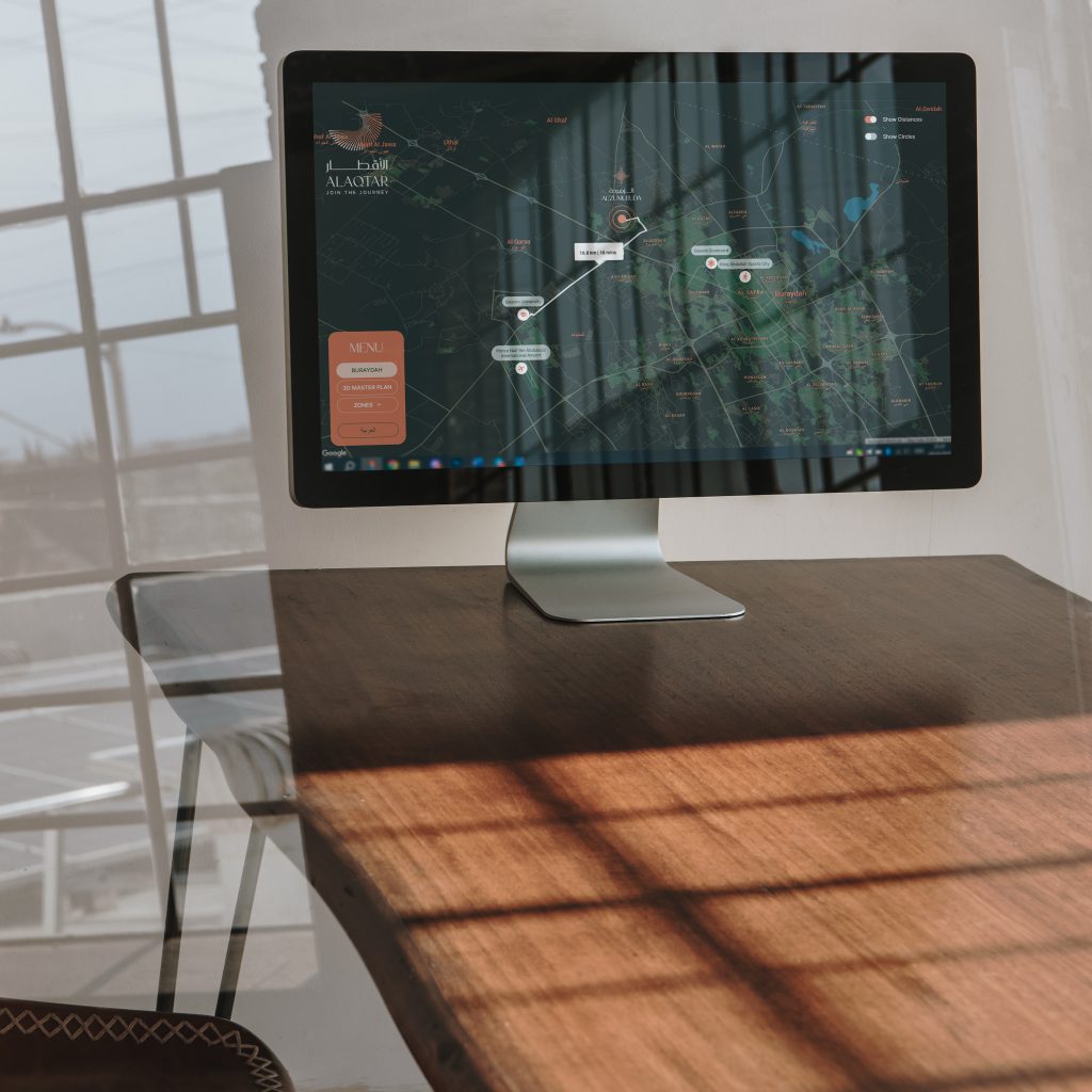
Absolutely. Digital Twins are ideal for residential communities, mixed-use developments, commercial districts, and entire masterplans. They allow users to explore infrastructure, amenities, transportation networks, and future development phases within a single interactive environment.

Our Interactive 3D Masterplan Applications

Interactive 3D Map 5
01

Interactive
Property Map

Interactive 3D Masterplan 3 Q02xgl1oknbq5jh7t2yrj5u3c16t0vlaxl6j6u60mw
02

Web Interactive 3D Apartment Masteplan

Interactive 3D Masterplan Q04j849ikk1tsku7sh04cwd3ddfja8736bpehstku0
03

Web Interactive 3D Villas

Banner Q04jcrksd2ev7636nhbpoq553yivccnb5bttx1xi2g
04 Unreal Enigne

Offline/Streaming Interactive 3D Masterplan

01Interactive Property Map

All in one – this is how you can describe Interactive Property Map. The most comprehensive information on all projects and the surrounding infrastructure is collected within one application. Save the client’s time on search and research: thanks to the configuration of filters according to the parameters that suit them, the consumers will receive the most helpful information, and as a result, you will have a loyal interested buyer.

Interactive Property Map LIVE DEMO

Try out the Interactive Property Map: Filter projects, Rotate the map, See distances between places, Explore the menu.

Icon 5

All Projects on Map

Icon 6

Show All Infrastructure Elements

Icon 7

Filter Projects on Map

Icon 8

Show Routes and Distances

All Features

All Features  2 768x366

Let's Get Started

Please, send us your project inputs and we will send you a quote.

When the scale of a project goes beyond a single house or villa, there is no more convenient solution to showcase your property than Interactive Property Map. Thanks to the fact that all your objects are indicated on an interactive map, the consumer has complete freedom to choose the future housing, taking into account the conveniences and infrastructure of the area.

Your client may have a family and children, so the school’s proximity to the house is a significant factor. Or they love shopping and entertainment, so a shopping center nearby will be more than just a pleasant bonus when choosing a housing. With the help of convenient filters, consumers can determine essential categories of infrastructure based on their preferences and depending on their location. Thanks to the route function, you can easily calculate the direct distance to objects.

Interactive Property Map is not limited to maps and panoramas from a bird’s eye view. Users can get comprehensive information about the object thanks to the 360 VR Tour and the detailed description of each object of the project.

Your Package

×
Dein Paket

×
Il tuo Pacchetto

×
Votre Choix

×
اختيارك

×
Your Request


×
Your Request


×
Your Package

×
Your Package

×
Your Package

×
Your Package

×
Your Package

×
Dein Paket

×
Dein Paket

×
Dein Paket

×
Dein Paket

×
Dein Paket

×
Il tuo Pacchetto

×
Il tuo Pacchetto

×
Il tuo Pacchetto

×
Il tuo Pacchetto

×
Il tuo Pacchetto

×
Il tuo Pacchetto

×
Votre Choix

×
Votre Choix

×
Votre Choix

×
Votre Choix

×
Votre Choix

×
اختيارك

×
اختيارك

×
اختيارك

×
اختيارك

×